Sunday, August 15, 2010
August 15, 2010 Looking Back
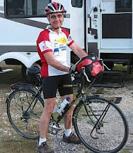
It's been almost a month since Steve And I finished our cross country ride.Looking back at what we have accomplished I find it hard to believe what we did. I'm still thinking about all we have seen, and all the people we met in this beautiful landscape we call our Country and home.As my life goes on I'll still picture the sites I've seen,and more important the people that put the magic I felt into each and every day.One thing I know for sure is that my live and my feelings about people and places will never be the same....Ted
Saturday, August 7, 2010

Thursday, July 22nd, Day 77
Eugene, Oregon
It’s over and very hard to believe that we did 4,200 miles on a bike and we navigated over 200 thousand feet of elevation across the country. The west was incredible with its mountain ranges and we can realize, with accurate and personal experience, the beauty of this country we call home.

Wednesday, July 21st, Day 76
Sisters to Blue River, Oregon
Our last mountain pass is today. And this is our next to last day on the ride. Imagine that.
Our objective is Santiam Pass at an elevation of 4,800 feet. Our hope today is to enjoy as much as possible of the ride we are embarking on. Let me tell you, it was totally enjoyable.
The climb to Santiam Pass was 21 miles that we both jumped on with eager anticipation. When we hit the summit, I think the two of us were relieved. This was the last pass, the last mountain climb, the last cold morning, the last of everything on this ride that started over 4,000 miles ago and also two months ago.
We are headed to Eugene and we both feel it’s all-downhill from here.
It’s hard to relate how powerful we feel.
More after we get to Eugene.
Tuesday, July 20, Day 75
Ochoco Divide to Sisters, Oregon (77 miles)
Today, in essence, was two days. The first three hours, then the rest of the day.
We woke up to 38-degree temps on top of Ochoco Pass. A breakfast from our bike pack certainly wasn’t what would help warm our chilled bodies. We started a 20 mile downhill that resulted in our stopping many times on the way down to warm our hands and faces that were being pelted by the frigid air. It was oh so cold.
In less than two hours, we were 30 miles down the road arriving in Primeville for a very welcome second breakfast. While there, we changed into our shorts and shirts from the warmer clothing that we needed on the road down. The temperatures were rising rapidly into the high eighties and low nineties. We Passed through Redmond and onto Sisters. We are staying in Sisters City Park tonight. A nice hot shower is the order of the day, however, the showers are not functioning at the moment. They’ll be ready tomorrow afternoon while we are on our way to Blue River. Bike Ted.


Monday, July 19, Day 74
Dayville to Ochoco Divide
Today we did two mountain passes, Keyes Creek, 4,350 feet and Ochoco Pass, 4,700 feet. We started from Dayville and passed through “Picture Gorge,’ and John Day Fossil Beds National Monument. This is an area of many fossil finds and is quite beautiful. We traveled through a canyon along the John Day River for about three miles. Then a long climb of about 20 miles to Keyes Creek Pass. Then up and over for a 7-mile downhill trek to the town of Mitchell, population 171 with two cafes and many boarded up buildings. We had a quick lunch then began the next climb, a mere 16-mile uphill trek to Ochoco Pass. This ride was a little on the rough side. When we hit the summit, we found the Forest Service Campsite and tented for the night. A very tired two bikers said good night at 8pm. Bike Ted


Sunday, July 18, Day 73
Austin Junction to Dayville, Oregon (61 miles)
This morning at 5:30am, it was 40 degrees. Steve and I had a “cold” breakfast at tent side. Needless to say, we dressed warmly and were on the road by 6:30. The day began with a climb to Dixie Pass at an elevation of 5,300 feet. It actually turned out to be an easy climb and we were up and over in a little more than an hour. The rest of the ride was downhill into our goal for today, Dayville. Enroute, we passed through Prairie City, John Day, Mount Vernon and finally into Dayville.
The cities and towns in this area of Oregon seem to be very alive and vibrant. It’s a welcome change from other areas of our country that were dismal and dreary. It’s nice to see because it’s making the end of this trip very interesting and colorful.
Bike Ted.


Saturday, July 17, Day 72
Baker City to Austin Junction, Oregon (54 miles)
The ride today required Steve and me to go through two mountain passes, Sumpter Pass at 5,100 feet and Tipton Pass at 5,150 feet above sea level. The two passes were about 14 miles apart. We had to climb, too, when leaving Baker City at 3,500 feet. So, you can see that most of the day was “UP.” We both worked hard this day and were rewarded with an 8 mile downhill on our way into Austin Junction.
We are tenting for the night.
A side note of the day…. I had my 7th flat tire (hope it’s the last) 12 miles outside Austin. Thank God it was the front tire…much easier to change. Till tomorrow. Bike Ted.


Friday, July 16, Day 71
Oxbow to Baker City, Oregon (72 miles)
This was the hardest day physically for the two of us. We moved out of Oxbow at around 6:45am and did not get to Baker City until almost 6:00pm. In between, we had a helluva day in Hell’s Canyon. There are only two small towns in the canyon…halfway, which was 17 miles out…then the mountain pass to another small town at 27 miles out. Then it was a 45-mile stretch to Baker City with no services, no food, no water and temperatures in excess of 100 degrees. It was a long, hot ride that had the two of us bouncing off the ropes. We both hung in there and agreed by day’s end that this was the most difficult of days we’ve experienced. Sleeping was very easy. Bike Ted.


Thursday, July 15, Day 70
Council, Idaho to Oxbow, Oregon (63 miles)
We did it. We have reached our last state, Oregon. We left Council and had a few short climbs on Route 95. Twenty-two miles later we were in Cambridge, Idaho for a second breakfast. We then moved off Route 95 and began a new trip on SR71. Another climb, this time 18 miles to the summit.at 4,131 feet. The pay back for that was a 7 mile downhill almost to the Snake River that is on the Oregon border.
A bonus tonight is we switch to Pacific time. That means, too, that we have about 400 miles left to finish our journey.
p.s. the Snake River and the Brownlee Reservoir that was created by the Brownlee dam is a sight to behold.


Wednesday, July 14, Day 69
Riggins to Council, Idaho (62 miles)
This morning, Steve and I left the Salmon River behind us as the sun was coming up over the mountains. Today was another steady climb of 35 miles to the town of New Meadows where we had our second breakfast. Then we had another climb of about 10 miles before we began a descent into Council.
On today’s ride, we had to follow Route 95 that became a big distraction for us. The shoulders were very narrow and there were many big trucks, tractor-trailers and the worst, logging trucks. The logging trucks were the ones that put the fear of God into me. They drive very fast in both directions…loaded and not loaded…and little pieces of bark and trees are flying off the truck as they pass you on the road.
For that reason, Steve and I couldn’t enjoy the eye candy as we have on other days while crossing Idaho. The drivers, however, do give us some room and for that, we are very thankful. Bike Ted.

Tuesday, July 13, Day 68
Kooskia to Riggins, Idaho (76 Miles)
The day started brisk but under sunny skies. The temps were in the high 50’s. These conditions are great considering we were about to enter into an almost 30 mile climb. We passed the town of Grangeville and did our final climb. The road had a strange name “Old White Bird Hill,” and this stretch of road took us to an elevation of 4,300 feet.
Our overnight has us at 1,200 foot elevation.
As we got to the top and took our last turn toward level ground, I looked to the left with Steve and could not believe my eyes. Before us was the most beautiful valley I’d ever seen and this actually was more magnificent than the Lochsa River and Clearwater area.
We could look off into about 50 miles of trees and green hillsides that looked like they were painted on canvas. Sooo, we both look at each other and said I can’t believe we are in Idaho. From that point on, the day got only better. We descended 12 miles down old Route 95 on a series of switchbacks that took us to the town of White Bird back to 1,600 feet of elevation. It was just remarkable.
From there, we followed the Salmon River for another 30 miles to the town of Riggins.
The river was a series of rapids following many twists and turns surrounded by hills and trees and our trip was a series of twists and turns without the rapids.
Today has to be another best day of our trip. Bike Ted and Fast Steve.


Monday, July 12, Day 67
Powell Campground to Kooskia, Idaho (88 miles)
We left the campground at 6:30 PST. We were following Idaho RT12 (Lewis and Clark trail) through Lochsa River Valley. The Lochsa River changed to Middlefork Clearwater River after leaving the valley. This area has to be Idaho’s most cherished secret. This valley was the prettiest we’ve seen on this trip and is by far the nicest I’ve ever seen. I would gladly return to this area in a heartbeat just to spend a little time marveling in the splendor of magnificent surroundings.
If you have four days that you can spare, come here for a great vacation.
Our day was dry with temps moderating in the high 80’s. The only drawback to this pleasant day was the headwind we had to fight during the final 30 miles or so. So Be It!!!
Our reservations tonight are in a motel in Kooskia. Kooskia is the gateway to the Clearwater and Nez Perce National Forest and the Selway Bitterroot Wilderness area.
Till tomorrow. Bike Ted!!


Sunday, July 11, Day 66
Lolo to Powell Campground, Bitterroot Range, Idaho (44 miles)
Steve and I are in our next to last state. This has been quite a journey and we have been witness to some of the most magnificent country in the world, bar none. The Bitterroot Wilderness is incredible and we are trailing the Lochsa River. This is part of the route traveled by Lewis and Clark during their great expedition. The beauty of this area is something that each person must judge for himself or herself. For me…there is no way to describe the forests, the rivers, the mountains, the creeks. It is a true feast for the eyes. We started by going up 25 miles to Lolo Pass…nice climb with a great view. This route was a continuation of the Lewis and Clark route.
We stopped for our second breakfast Bear Cave Bar and Grill in Lolo and waited almost an hour to be served. It set a new record of slowness for us. We have seen some pretty slow service but this takes the cake.
From there, we started downhill to Powell Campground. We both were looking forward to an early end to the day and to a good night of rest before heading tomorrow to Lowell, Idaho.
Subscribe to:
Comments (Atom)